Simplify Your Bulletins Live! Two Compliance
Stay informed and compliant with our comprehensive endangered species mapping and reporting system designed for growers and applicators.
$50/Field
- Field-specific compliance tracking
- Automated Runoff Mitigation Tracking
- Automated Soil Moisture Monitoring
- Drift Mitigation Tracking Per Application Event
- Automatic Compliance Reports
A Closer Look at Our Platform
Easily and quickly track your compliance with Bulletins Live! Two
Detailed Field-Level Insights
See how pesticide use limitation areas overlay with each field.
Automatic soil mapping and mitigation point tracking based on soil types and hydrologic zones.
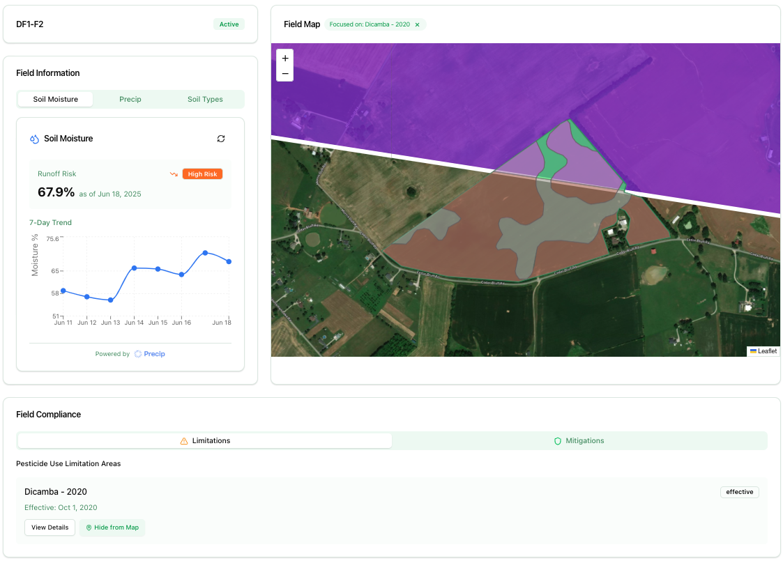
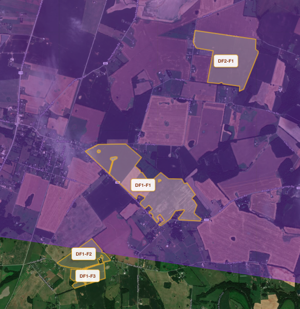
Comprehensive Field Overview
View all of your fields in one map with pesticide use limitations overlaid.
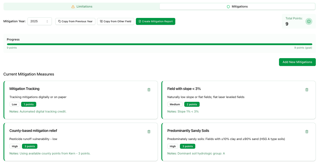
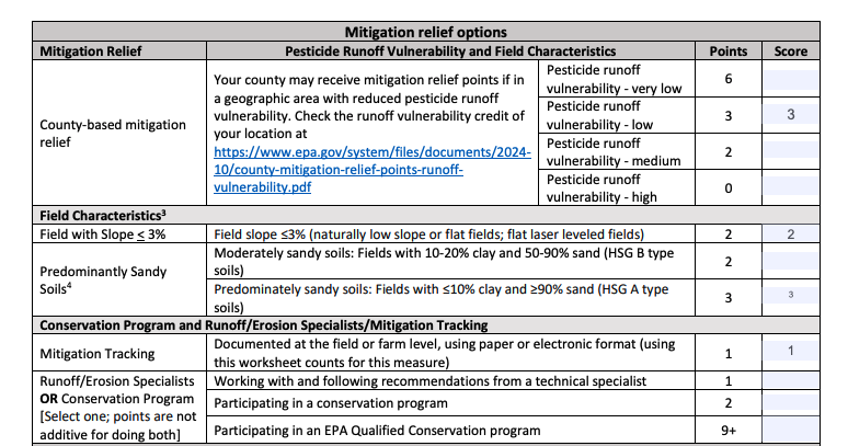
Streamlined Runoff Mitigation Management
Automatic county mitigation points added for each field.
Easily view additional mitigations that are available for the field.
Track runoff mitigation points easily.
EPA Runoff Mitigation Reports
Automatically generate EPA-compliant runoff mitigation reports pre-filled with your field data.
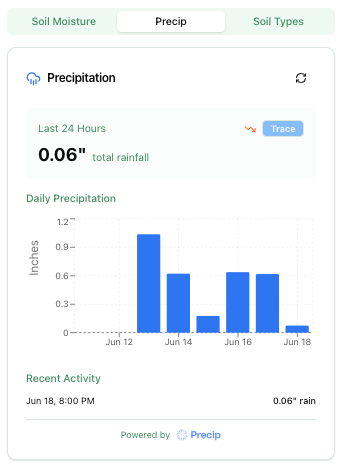
Advanced Precipitation Tracking
Precipitation tracking for each field.
Powered by

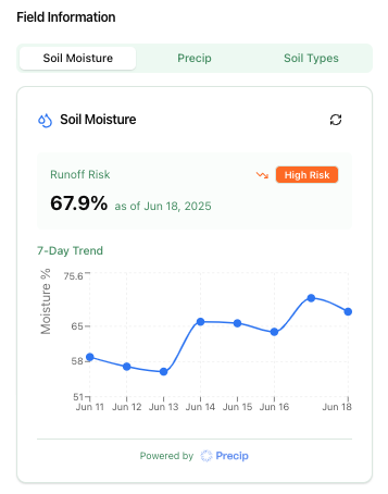
Proactive Soil Moisture Analysis
Soil moisture and runoff risk for each field.
Powered by